 |
|
||||
|

High,
High Tech
The Science of Satellite Tracking
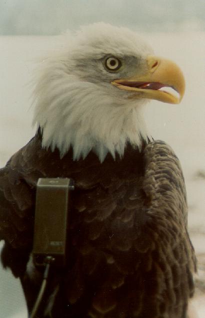
In order to track an eagle by satellite, a transmitter must be fitted on the eagle's back. The transmitter fits like the backpack you might wear to school. Notice the black straps shown in the picture below. The straps go in front of and behind both wings, and are stitched together in the front. An antenna hangs down the eagle's back and sends radio signals.
|
Eagle
with satellite backpack. |
 |
 |
These backpacks are known as "PTT's," which is short for "platform transmitter terminals." The eagle's PTT is powered by a battery. Because the battery wears down each time it's used, the PTT can't constantly send signals. To save battery life, the PTT is programmed to send radio signals according to a schedule the scientist sets. For example, Peter Nye programs the PTT to emit signals every 2 days. His eagles' batteries now last for approximately 2 years.
The eagles' signals are picked up by polar-orbiting satellites when they pass high overhead. Just think: Zipping through space, the same satellites are picking up signals from other Journey North species--from the manatees and whooping cranes in sunny Florida all the way to the the caribou in the cold Arctic.
|
|
| NOAA-15 before launch |

- The satellites travel 833 km above the earth
- It takes the satellite only 101 minutes to circle the earth!
- NOAA-15 (see photo) was launched May 13, 1998 Vandenburg Air Force Base, CA
- Weight at liftoff: 2,231 kg (4920 pounds)
- Length: 4.2 meters (13.75 feet), Diameter: 1.88 meters (6.2 feet)
The satellites receive the message sent by the transmitter and the transmitter's location (its latitude and longitude) are calculated by computers on the ground. The locations are calculated using what's known as "the Doppler shift." You've experienced the Doppler shift if you've ever listened to the shift in sound a race car or train make when approaching and then traveling past you. (With your voice, make the high-pitched sound of an approaching race car, then the zooming sound it makes as the car races past you, and its pitch quickly slides lower.)
According to Service Argos, the company who provides the satellite-tracking service to scientists, "When the satellite 'approaches' a transmitter, the frequency of the signal measured by the satellite receiver is higher than the actual transmit frequency, and lower when it moves away." This is the basis for calculating location.
Copyright
2002-4 Journey North. All Rights Reserved.
Please send all questions, comments, and suggestions to our feedback form


