|
GRAY WHALE MIGRATION ROUTE
1)
 |
Lucky whalewatchers touch a baby gray whale
in Laguna Ojo de Liebre.
Photo Linda Lewis
|
MAGDALENA BAY, Baja California Mexico
This is the southernmost nursery of Mexico's
Baja California coast. The fewest number of gray whale births occur here. At peak, only an estimated 250-500 gray
whales are here. This deepwater fishing port is the only area the whales come to which is not part of the biosphere
reserve. Magdalena Bay is 180 miles (270 km) south of San Ignacio.
2) LAGUNA SAN IGNACIO, Baja California Mexico
San Ignacio is about 500 miles south of
San Diego, and 80 miles (120 km) south of Laguna Ojo de Liebre. This rugged and remote lagoon is 16 miles long
and 3 to 4 miles wide. Several hundred whales come and go at any given time during the season. Thanks to Mexico's
2000 veto of a proposal to build a huge saltworks here, this breeding and calving grounds remains untouched by
human development. . .and safe for whales who arrive there each winter.
3)
LAGUNA OJO de LIEBRE, Baja California Mexico
The largest number of gray whales come here.
More than half the gray whale births take place in Laguna Ojo de Libre. The lagoon is a half-hour drive from the
town of Guerrero Negro. Formerly known as Scammon's Lagoon, this huge watery complex is named for Captain Charles
Scammon, who charted many of these areas in the mid-1800s as he hunted gray whales. UNESCO has named Laguna Ojo
de Liebre and Laguna San Ignacio a World
Heritage Site because they are important
breeding and calving areas for the gray whale.
4) LAGUNA GUERRERO NEGRO, Baja California Mexico
Fewer whales come here than to Laguna Ojo
de Liebre. Guerrero Negro means "Black Warrior." It is named after a whaling ship that went down in this
lagoon in 1858. The world's largest salt production facility is located on this lagoon. The saltworks
offices are in the nearby town of Guerrero Negro.
5) Census Site for ACS/LOS ANGELES,
California (33.44 N, -118.24W)
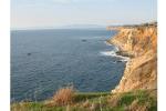
The observation post of the American Cetacean Society (ACS) Census is on Palos Verde Peninsula, about 8 miles north of the Los Angeles
Harbor in southern California. Each spring, trained volunteers count migrating whales passing on their way back
from warm Mexico to the cold Arctic. The main pulse of northbound whales, mostly adults, usually occurs the second
and third week of March. A second pulse of
 |
The ACS/LA census
site is 125 feet above sea level. See any whales?
Photo Mike Hawe
|
mother/baby pairs comes about 6 weeks later. Most of the world's gray whales migrate past California, but census
observers see only a small portion of them. That's because whales travel farther offshore here. Also, bad weather
can prevent observers from spotting the whales. The counts help us find out whether whales' seasonal usage of this
nearshore migratory path change over time. What story will the numbers tell about gray whales this year? Track
the whales passing the ACS/LA Census with Journey North this spring.
6) CHANNEL ISLAND NATIONAL MARINE SANCTUARY, California (34.40 N,
-119.69 W)
Channel
Islands National Marine Sanctuary (CINMS) near Santa Barbara, CA
offers great whale watching. It is home to some 28 species whales,
dolphins, and
other sea creatures in 1658 square miles of protected ocean habitat.
It is home to the new American Cetacean Society-Channel
Islands (ACS-CI)
census for northbound gray whales, starting January
29, 2005.
 |
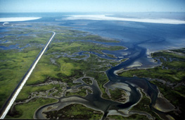
Aerial view of Point Piedras Blancas, CA.
|
7) POINT PIEDRAS BLANCAS, California
Biologist Wayne Perryman (with National
Marine Fisheries Service) counts the mothers
and calves that pass Point Piedras Blancas, CA on the new babies' first journey north each spring. The cows and
calves are the last whales to leave the warm lagoons and swim north.
8) MONTEREY BAY, California (36.37N,
-121.54 W)
The National Marine Mammal Lab (part of
NOAA) operates a whale counting station just a few miles south of Monterey. The whales migrate within a few miles
of shore near Monterey so they are easily counted when weather is clear.The first northbound whales off the California
coast are usually seen in early to mid February.
9) NEWPORT, Oregon (44.64N, -124.00W)
Gray whales can be seen year-round off Oregon,
but November and December bring the first whales migrating south. On the journey north in spring, mothers and calves
on usually pass Oregon and Washington from late April through June, several weeks after the males and juvenile
females without babies.
10)
SEATTLE, Washington
By early April, almost 20 percent of the
eastern Pacific population of gray whales are off the coast of Washington. The rest are strung out along the Pacific
Coast of North America from Central California to SE Alaska on their journey north.
11) VANCOUVER ISLAND, BC, Canada (49.11N, 125.88 W)
Most of the grays en route to the Bering
Sea pass Vancouver Island in March and April. Some of the gray whales stop and stay for the summer! In October
or November, these "resident grays" join up with the whales migrating south to Mexico.
Kodiak Island, Alaska
 |
12) KODIAK ISLAND, Alaska (57.43N, -152.34W)
The first returning adult males can arrive
in mid to late March. Mother-calf pairs normally return in mid-May and keep coming into July. Kodiak holds a Whale Fest to celebrate the whales' return each spring.
13) NELSON LAGOON, Alaska (55.92N, -161.35 W)
Some gray whales like to spend the summer
in bays along
the Alaska Peninsula. Some stay in Nelson Lagoon, feeding in a narrow channel.
There's still a long way to swim before
they reach the prime feeding areas in the Chirikof Basin, south of the Bering Strait.
14) UNIMAK PASS, Alaska
Most northbound whales (except for the early
ones) migrate through narrow Unimak Pass in June. They are just a few weeks away from their arctic feeding grounds!
15) BERING SEA
The gray whales swim farther north only
as the melting ice permits. Because the whales wait until after the ice is gone, people look at changes in the
Bering Sea ice maps to help them know when the gray whales will return. Gray whales and the whales with dorsal
fins usually don't swim as far as Point Hope, AK until July!
16) CHUKCHI SEA
Click here
to check out today's ice maps for the Bering and Chukchi
Seas. How
far can the whales go before ice stops them?
Copyright 2002-2005 Journey North.
All Rights Reserved.
Please send all questions, comments, and suggestions to our feedback form
|


