| Map
Questions: Temperature Maps |
| Journey
North uses lots of weather maps in our studies of seasonal change.
This week we'll look at some temperature maps. |
| U.S Temperature Maps: |
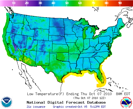
| Predicted U.S.
Minimum Temperatures: Oct.7 (°Fahrenheit) |
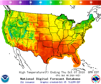
Predicted U.S.
Maximum Temperatures: Oct.7 (°Fahrenheit) |
 |
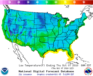 |
Each map (above) tells its own story.
Study the colors in each map and the temperature key at the top.
- What is the warmest temperature predicted? What color is it?
- What is the coldest temperature predicted? What color is it?
- Notice the ocean temperatures next to the continent. How would you describe them on each map?
- Now YOU list 3 questions about the maps to ask your partner or classmate.
|
|
Europe Minimum Temperature
Map: |
| Extreme
Minimum Temperatures: Sept. 26 - Oct.2 (°Celsius) |
This map tells a different story from the maps above in many ways. First, this map shows temperatures that really happened. How is that different from the U.S. maps?
List more ways this map is different:
- .
.
- .
.
- .
.
- .
.
- .
|
 |