Date: 04/08/2017
Number: 1
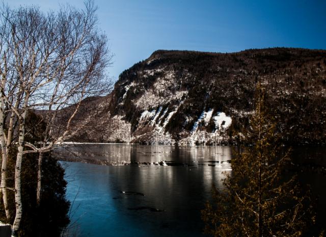
"This is Lake Willoughby the day of ice out April 8, 2017. The mountain is Mt Hoar. Not in the scene is Mt Pisgah, together these two mountains form the pinch of the hour glass shape of the lake. This stretch of water is the deepest part of the lake. The USGS estimates its depth at 302', the U.S. Navy says its 340', locals say "Its dang deep!". So I guess it up to the viewer to pick one. Lake Willoughby is known for its record size Lake Trout. The record of 46 3/4" has stood for some 30 years. Fisherman routinely pull in fish well over 15". This capture was taken about 9 AM after the sun had crested Mt Pisgah. I didn't use a polarizer for this take. I did use a polarizer with other shots and found I lost the blue of the skim ice in the foreground and the blue gradient of the sky was greatly lessened. I think in this case the reflected glare of the snow on the ice contributes to the overall impact of the scene. I hope you like this view of my backyard ... B-)) Bob "
Photo and report courtesy of Bob Pelle, as seen on the FanArtReview website.
Barton, VT
Latitude: 44.8 Longitude: -72.1
Observed by:
Contact Observer
The observer's e-mail address will not be disclosed.
Contact will be made through a web-based form.