 |
|
||||
|


Bald Eagle Migration Update: February 4, 2004
Today's Report Includes:
- Welcome Back to Bald Eagle Biologist Peter Nye
- Field Notes from Peter Nye
- High, High Tech: The Science of Satellite Tracking: Challenge Question #1
- Fall Migration Map: A Magic Eye of Surprises
- Teacher Tip: Student Portfolio Organizers for Assessment
- Teacher Tip: Are YOU Ready for the Migration?
Welcome Back to Bald Eagle Biologist Peter Nye
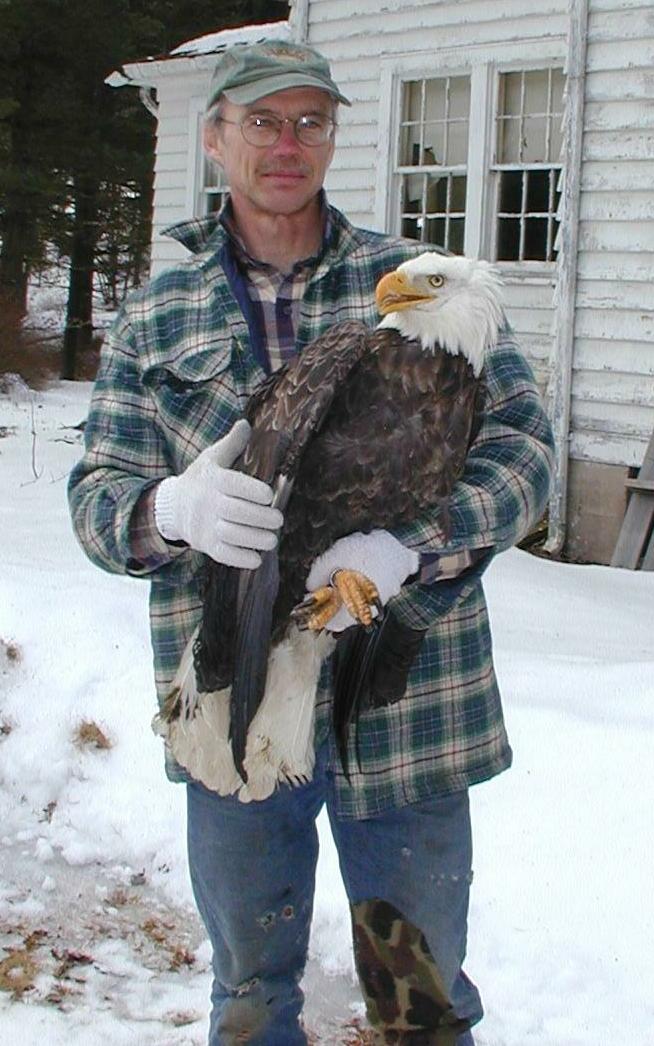 |
Peter
Nye with E63 |
We’re proud to welcome the return of "Eagle Eye" Nye who's back for the 10th season! Nye is one of the top eagle biologists in North America, and we're grateful for the chance to look over his shoulder each year as he conducts his important work.
Take a minute to meet Eagle Eye Nye and to learn about his research:
Field Notes from Peter Nye
Hello Journey North Eagle Trackers!
 |
Scott
VanArsdale and A00 |
Where
did A00 go? Visit the Eagle Map Archives |
Welcome to another year following some of our eagle work here in New York State. 2003 was a very busy year for us. Those of you with us last season will recall our exciting efforts to capture one of two golden eagles wintering here in eastern NY, efforts that finally paid off with the capture of tagging of an adult male golden, A00 on 11 March 2003.
A00 migrated to, summered in, and presumably nested in northern Quebec, just west of the Labrador border. You can go back into the archives and follow his track, and calculate the distance from his winter-home to his summer home. We believe this bird was one of a mated pair, and this winter Scott VanArsdale of our staff and I have targeted his mate, the adult female, for capture and radio-tagging. Virtually nothing is known about migratory behavior and movements of mated pairs of eagles, either balds or goldens, and this is one of the areas of interest to us. Questions like:
- Do mated pairs migrate together?
- Do they use the same wintering areas?
- Do they leave at the same times (both spring and fall)?
- Do they stay together all winter?
We have had few opportunities to capture both birds of a mated pair, so this should be exciting and a significant challenge, trying to capture one particular bird. I sure you can expect to hear more from Scott on that endeavor as he gets going with it, likely next week.
New Initiative
on the Delaware River
Beginning with this winter season, we are now embarking on a four-year
study of eagles along the Delaware River, along our southern border with
Pennsylvania (look at a map and find it). The "main-stem" of
the Delaware runs along our border for about 73 miles, from Port Jervis
to Hancock, New York. This will be a cooperative study with the National
Park Service, since this river section is part of the Upper Delaware Wild
and Scenic Recreational River, a national designation.
So, there you have it. A quick sketch of what we will be up to this winter. I'll send along more info as the weeks pass, and look forward to your participation.
Thanks for your interest!
Regards, Pete (Eagleye) Nye
New York State Dept.
Environmental Conservation
Delmar, NY
High, High Tech: The Science of Satellite Tracking
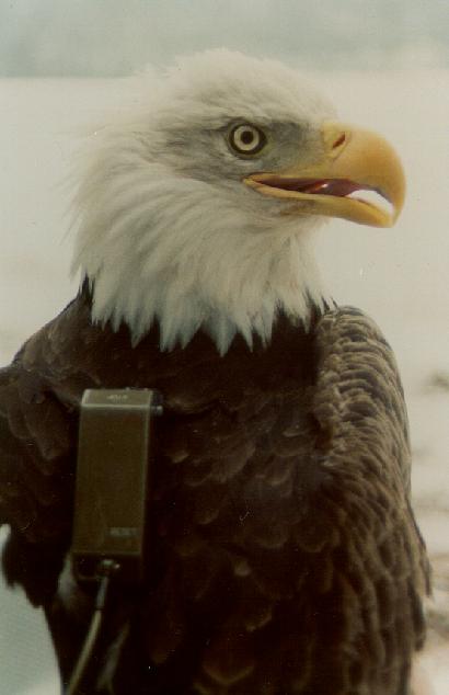
In order to track an eagle by satellite, a transmitter must be fitted on the eagle's back. The transmitter fits like the backpack you might wear to school. EagleEye Nye programs the transmitters to emit signals once every 2 days. The straps of these lightweight backpacks are hand sewn onto each eagle with a thread that will decompose in about 2 years- the approximate lifetime of a transmitter battery.
|
Eagle
with satellite backpack. |
 |
 |
The satellite,
orbiting high above Earth’s atmosphere becomes a tool in the complex
transfer of data across the miles of space to show us where we can find
our eagles.
Carefully read and learn more about this technology:
Now sharpen your pencils and calculate this:
Challenge Question #1:
"How many miles above the earth do the polar-orbiting satellites travel?"
(To respond to this question, please follow the instructions below.)
Fall Migration Map: A Magic Eye of Surprises
Maps hold hidden surprises. Like those graphic puzzles called “Magic Eyes,” the longer you look at them the more chance you will see the surprises they contain.
Let’s begin the spring season with a simple map showing the fall migration of some of our satellite tagged eagles.
 |
| Fall
2003 Migration Map |
Study the map for its hidden meanings. Look carefully- what statements can you make from looking at the map? How would you can accurately answer these questions:
- What do the dots (symbols) represent?
- How often is the transmitter sending a signal?
- What do the green lines on the map represent?
- What might be happening when there is a cluster of data points in one location?
- How far are the eagles traveling between data points?
- How many miles/kilometers did each migrate last fall?
- What else do you wish the map could tell us?
Teacher Tip: Student Portfolio Organizers for Assessment
A new Journey North season brings lots of excitement. Students gather information, send in field observations, study maps, calculate migration distances and spend time researching topics of special interest. All of these activities promote rich learning experiences. The challenge is how to organize this vast amount information for project assessment. A creative project portfolio is one answer!
 |
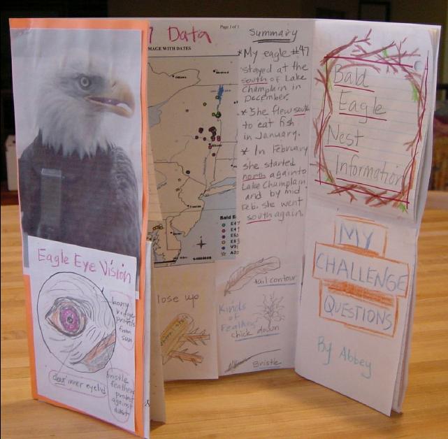 |
| "Shutter"
fold student portfolio |
Self-contained
organizer makes a simple and complete display |
Teacher Tip: Are YOU Ready for the Migration?
Our satellite-tracked eagles typically begin to migrate in March. Depending on the age of your students, the skills you want to teach (and your own comfort level with satellite data!), you may want use the migration data in various different ways. Here are some tips and background lessons to help you get ready:
Make
Your Own Migration Map, Or Print and Analyze Ours
The satellite data provides an excellent exercise in use of latitude and
longitude, and plotting the data develops students' mapping skills. In
each update, we provide the same data points that Peter Nye receives from
the satellite. We provide you information so you can order an area map
(Recommended Tracking Maps)
to help you visualize the tracking territory. However, if mapping is too
difficult or laborious (or if it simply doesn't meet the skills your students
are learning), you can skip the mapping step completely and simply print
out our weekly maps for analysis. Our Challenge Questions usually refer
to the interpretation and analysis of data, so even if students do not
make their own maps, they won't miss this important component.
This lesson will help you get comfortable with satellite data, so you'll have a feeling for the distances involved when an eagle's latitude and longitude readings change.
This lesson includes charts with step-by-step instructions for pinpointing an eagle's latitude and longitude on a map. By putting a transparency on top of your map, an eagle's exact location can be more easily found.
How to Respond to Today's Challenge Questions:
IMPORTANT: Answer only ONE question in each e-mail message.
1. Address
an e-mail message to: jn-challenge-eagle@learner.org
2. In the Subject Line of your message write: Challenge Question #1.
3. In the body of EACH message, answer ONE of the questions above.
The Next Bald Eagle Migration Update Will Be Posted on
February 11, 2004.
Copyright
1997-2004 Journey North. All Rights Reserved.
Please send all questions, comments, and suggestions to our feedback form
![]()
![]()
![]()
![]()
![]()
![]()
