

 |
 |
 |
 |
 |
| Satellite
Tracking and Manatees |
 |
Tie a Belt Around Your Peduncle!
All this
talk about "tags" and transmitters may have you wondering. What
do the tags look like, how are they attached to the Manatees, what kind
of signals are sent out or received, how long do they last, what is a
'tip' and what happens if the tag gets caught in something?
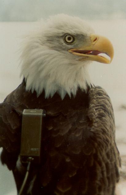 |

Journey
North students tracking the migration of the Bald Eagle know that the
eagle wears a "backpack" transmitter. Manatee tags, on the other
hand, are attached with a "peduncle belt" and a "nylon
tether." The belt goes around the manatee just in front of its tail,
in an area called its "peduncle", and the tether is a stiff
nylon rod (about 10 mm in diameter and 130 to 200 cm long) that connects
the belt to the tag. Each tether has a "weak link" built into
it, which will break and allow the manatee to swim free if the tether
or tag ever become snagged on something such as a dock, a boat, thick
vegetation, or even a hungry alligator!!

Credit Birmingham Zoo |
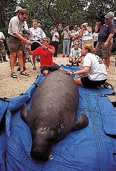
Take a look at this video of scientists fitting a captured manatee with an transmitter and the releasing it back into the water:
Watch a Manatee Being Fitted with a Transmitter |
|
|
click to enlarge |
Radio Waves
Jim
Reid and Susan Butler from the Sirenia Project explained that most manatee
tracking has been accomplished through the use of very high frequency
(VHF) and Argos-monitored radio-tags. Both of these systems are usually
combined in one tracking tag, and both rely on radio transmitters to broadcast
signals from the tagged manatee. The tags are also usually
equipped with a third transmitter, which gives off sonic beacons.
Signals from the Argos transmitter are received by NOAA weather satellites
and relayed back to earth for processing; researchers then use computers
and the Internet to get the calculated locations from Service
Argos. To locate a Manatee, scientists will begin with location coordinates
from the Argos satellite system, and travel to that area.
|
|

The radio transmitters are contained inside of floating plastic cylinders about 39 cm long and 9 cm in diameter. The cylinders have a 20 cm wire antenna on the top of them, and every cylinder is color-coded with large identifying letters and engravings on them.
|
|

Typically, the PTT will send from two to six different
location points for each tagged manatee every day. Besides "location"
information, data is also sent on manatee "activity" (# of dives,
duration of dive, # of times the transmitter "tips" greater
than 90 degrees, i.e. swimming, playing, etc) and temperature.
|
|

"Beeping" or "Listening":
The Difference Between Radio-Tags and GPS Tags
Jim Reid pointed out that radio tracking and GPS tracking are very different
processes. "Unlike the radio tag which sends signals ("beeping"),
the GPS tag attached to the Manatee is a radio receiver ("listening")
that is tuned to signals being transmitted from NAVSTAR
satellites. The GPS receiver then calculates a location and stores it
to memory in the tag. These locations are normally very accurate and the
tag can be programmed to obtain many locations per day. Unfortunately,
the GPS tag must be recovered for us to download the stored locations
and plot where the manatee has been. New technology is being developed
to relay the stored GPS data to researchers, perhaps through an Argos-monitored
transmitter!"
For more details on GPS Technology go to:
Special thanks to Service Argos for their ongoing assistance.
Copyright
2001-2003 Journey North. All Rights Reserved.
Please send all questions, comments, and suggestions to our feedback form
|
|
|
|
|
|
|
|

