Background
Lessons for Journey North |
||
| |
||
Global
Climates and Seasons
Precipitation
(
<< Back
to Lesson)
This animation shows how global precipitation changes throughout the year. Precipitation includes rain, snow, sleet, etc. First take time to understand the map.
-
The horizontal lines represent latitudes. (Can you find the equator?)
-
The color key at the bottom shows the range from very little precipitation (on the left side) to lots of precipitation (on the right side).
- Try to locate where you live (approximately).
- The first few times you look at the animation, look at precipitation patterns on the entire globe. (Try starting in January.)
- The next few times through, look at precipitation patterns just in North America.
- Answer the questions below the map. You can review the animation as you try to answer the questions.
| Average Precipitation Through the Year (Link to full-size map) |
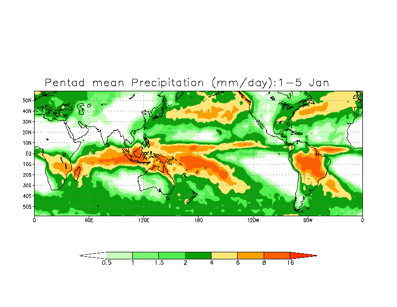 |
- What patterns do you notice? What general statements can you make about global precipitation?
- Which areas/latitudes tend to have the most precipitation? The least?
- What happens to the rainiest bands throughout the year? (Look at Central and South America.) Which direction(s) do they move?
- Point to a place in North America that you think might have a rainy season and a dry season. Explain why you think so.
- Point to your migrating animal's winter and summer habitats. What does this map tell you about the moisture conditions that it needs to survive — or that it can survive in?
Find
out what scientists think >>
© 1997 – 2025 Journey North. All rights reserved.
![]()
![]()