
Arctic Trekking with Scott Hed*
Part Two:
Rafting the Kongakut River to the Arctic Ocean
(Back to Part One >>)
This is the final installment of Scott's journal. Read on to learn more about the fascinating ecosystems of the Arctic National Wildlife Refuge that the Porcupine caribou herd calls home.
 |
|
Packing the rafts
Credit Scott Hed |
Rafting Along
When I woke in the morning, the fog had cleared and it was a blue-sky day.
The planes came in and some people left and some others arrived for the rafting
portion of our journey. We unloaded all of the gear, including the three
four-person rafts that would carry us to the Arctic Ocean over the course
of the next ten days. The pile of gear and food was enormous compared to
what we had on the backpack trip. Then I remembered that we no longer had
to carry the stuff on our backs…we’d just float it down the river
to our next camp site. From the camp sites we would take day hikes to explore
the surrounding country. This seemed like living in luxury compared to the
backpack trip. We even made pizza one night!
We were fortunate to be present when spring came into bloom. There were countless
varieties of wildflowers of every color. All the plants on the north side of
the Brooks Range are very small. The growing season is short, and they hug
the ground to conserve warmth in the cool wind that is nearly ever-present.
Along the riverbanks grow dwarf willows and birches that are more like shrubs
than trees. Otherwise, most plants are only a few inches high.
 |
Grizzley bear
Photo courtesy USGS |
 |
|
Caribou train: 5 hours
long
|
As we made our way north, the foothills began to flatten out into the
broad coastal plain. We still saw grizzly bears, but not as frequently
as in the foothills and mountains where they prefer to spend their time.
We kept seeing caribou every day. We started to see more and more different
types of birds, including golden eagles, which are large enough to carry
off sheep or caribou calves.
5-hour Caribou Trail
Our last camp in the foothills was the location of
a sight I will never forget. As we sat finishing breakfast, a group
of caribou arrived on the ridge above us and started down toward our
camp. They were headed toward the banks of the Kongakut River and were
going to cross to the west and out onto the coastal plain, the destination
that they had been seeking in their hundreds of miles journey from
their wintering grounds. For five straight hours we watched as thousands
of caribou (how many I can’t even guess) made their way right
through our camp! They were all cows and newborn calves. There had
been a late spring and the caribou were forced to have their calves
on their way to the coastal plain instead of on the coastal plain like
they traditionally do. This was bad because a higher percentage of
calves did not survive the perilous journey. The calves we watched
from our camp were the “toughest of the tough” – they
had already crossed many rivers and evaded wolves and bears. They just
plunged into the rushing river after their mothers, and because they
couldn’t swim as strongly as the adults they were swept downstream
quite a distance before finally emerging. They shook off the water
and ran ahead to catch up to their mothers. It was an unbelievable
sight, and made me realize just how important the coastal plain is
to the caribou herd’s survival. They need this area because they
are not disturbed by human development or predators, the area has just
the kind of nutritious vegetation that gives the caribou mother’s
the richest milk of any land animal, and the cool breezes off the Arctic
Ocean keep the mosquito disturbance to a minimum.
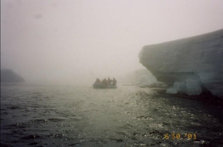 |
Ice canyons: Kongakut
R. approaching the Arctic Sea
Credit Scott Hed |
Canyons of Ice
As we approached the coast of the Arctic Ocean, we traveled through canyons
of ice that stood 10 feet high on the banks of the river. Often, the river
would fork into numerous braids, which we would have to stop and walk ahead
to see which was the correct path, and which were dead ends. Eventually,
in a dense fog, we emerged in a lagoon at the coast of the Arctic Ocean.
We camped for three nights on a narrow band of land called a “barrier
island” just off the mainland. To our south was a freshwater lagoon
and the lands of the Arctic Refuge. To our north was ice as far as we could
see covering the Arctic Ocean. We saw dozens of seals out on the ice. I remembered
that seals are the preferred food of polar bears. Polar bears are the one
species of bear that is known to stalk and kill humans. So I figured that
with all of the seals on the ice, any polar bear would have plenty to keep
it busy. Then I thought “What if the bear can’t catch any seals?
Will it decide to come see the slow creatures sleeping in the colorful tents
on the island?” Well, we didn’t see any polar bears, but we did
see some very big tracks in the sand. Maybe it would have been nice to see
a polar bear from the airplane! Another reason the coastal plain of the Arctic
Refuge is so important is that it is the location of the highest number of
land dens for polar bears in America’s Arctic regions. Since the Arctic
ice pack is gradually melting (due to global warming?), more and more polar
bears are denning on land instead of on the ice.
 |
Dishwashing in the Arctic
Ocean
Credit Scott Hed |
Frosty Arctic Dip
One night after nearly everyone else had gone to sleep, a few of us took a
hike and upon our return we started a campfire. It was a nice evening and
the fire was warm. I figured I may never again have the opportunity to take
a swim in the Arctic Ocean, so I did it! I stripped down to my shorts and
sprinted out into an area of open water. There was ice all around me and
even on the bottom – and it was freezing! After completely submerging
my body, I quickly ran back to the campfire to warm up and dry off. The hot
chocolate helped out a lot as well. I’m not sure if it was bravery
or stupidity, but I was the only one in the group to take a dip in the Arctic
Ocean!
 |
Prudhoe Bay oil development
|
 |
Burning off propane
at Prudhoe Bay
Photo credits Pam Miller |
Pristine Wilderness to Oil Field
Development
When my 18 days in the Arctic Refuge came to an end, a plane picked
us up from the barrier island and flew us to Kaktovik, an Inupiat
Eskimo village on the
northern border of the Arctic Refuge lying on the edge of the Arctic Ocean.
After 18 days of not showering, that was the best shower of my life! We enjoyed
a home-cooked meal at our pilot’s hotel and a restful sleep in a bed.
The next day a few of us flew from Kaktovik to Deadhorse, the “town” at
the center of the Prudhoe Bay oil fields. The oil fields lie just to the west
of the Canning River, which marks the western boundary of the Arctic Refuge.
As we descended into Deadhorse, I noticed a brown layer of smog in the air
above the oil fields. It was more like flying into Los Angeles than Alaska’s
Arctic. The departure from the airplane into the heart of the largest industrial
site on the planet (over 1,000 square miles of development, 100’s of
miles of roads, and growing) was the rudest awakening of my life. After nearly
three weeks of hearing nothing but the sounds of the wind, the river, the animals
and birds, and the sound of my companions’ voices, the sound of heavy
equipment was an assault to the senses.
Saving the Arctic National Wildlife Refuge
I knew right then and there that we cannot let the coastal plain of the Arctic
Refuge meet the same fate as had befallen the area around Prudhoe Bay. After
all, the coastal plain of the Arctic Refuge is the only 5% of Alaska’s
North Slope that is protected from development. The other 95% is either currently
producing oil or will be available for future development. Where do we draw
the line? At the Canning River, and the border of the Arctic National Wildlife
Refuge, that’s where.
Scott Hed is the Plains, Prairie and Northland Organizer for the Alaska Coalition.
© 1997 – 2025 Journey North. All rights reserved.![]()
![]()